Reiek
Hill StationReiek, a picturesque village nestled in the Mizo Hills of Mizoram, India, is a serene escape offering breathtaking panoramic views and a deep dive into the indigenous Mizo culture. Perched at an altitude of approximately 1,465 meters, Reiek is renowned for its lush green landscapes, dense forests, and the iconic Reiek Tlang, a mountain peak that provides an unparalleled vista of the surrounding valleys, the sprawling Aizawl city, and even the distant plains of Bangladesh on a clear day.
About Reiek
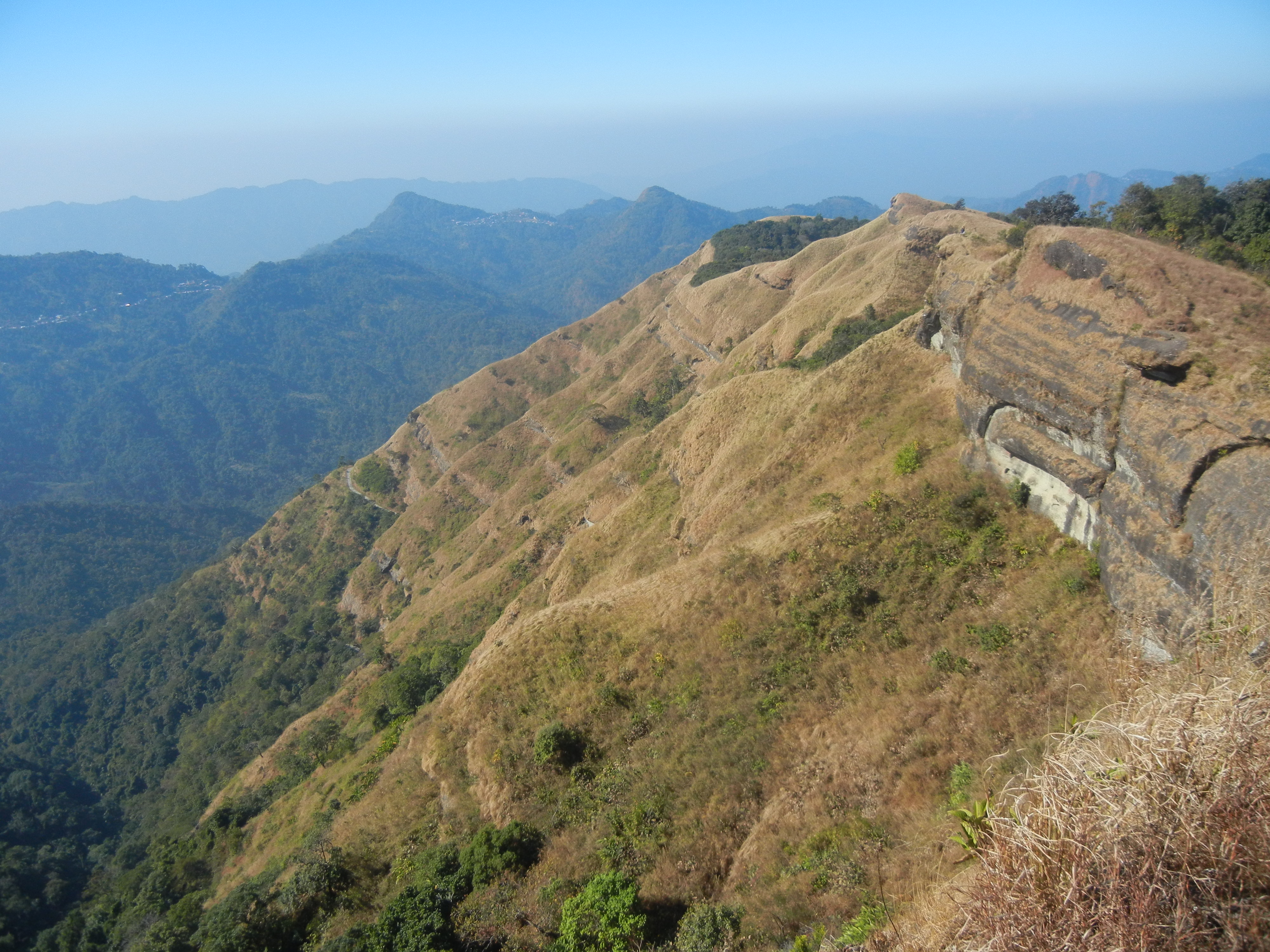
Reiek, a picturesque village nestled in the Mizo Hills of Mizoram, India, is a serene escape offering breathtaking panoramic views and a deep dive into the indigenous Mizo culture. Perched at an altitude of approximately 1,465 meters, Reiek is renowned for its lush green landscapes, dense forests, and the iconic Reiek Tlang, a mountain peak that provides an unparalleled vista of the surrounding valleys, the sprawling Aizawl city, and even the distant plains of Bangladesh on a clear day. The village itself is small but vibrant, with traditional Mizo houses and a tranquil atmosphere that invites contemplation and relaxation. It's a perfect destination for nature lovers, trekkers, and those seeking an authentic cultural experience away from the bustling urban life. The cool, crisp air, the chirping of exotic birds, and the pristine environment make Reiek a hidden gem waiting to be explored. Locals are friendly and welcoming, often sharing insights into their unique way of life and the rich history of their land. Its relative obscurity adds to its charm, ensuring an unspoiled and intimate travel experience.
History
The history of Reiek is intricately linked with the ancient traditions and oral histories of the Mizo people. While specific historical dates and kingdoms might not be as documented as in other parts of India, the area around Reiek has been inhabited by various Mizo tribes for centuries, each contributing to the rich cultural tapestry of the region. The Mizo Hills, including Reiek, were historically characterized by jhum (slash-and-burn) cultivation, which shaped the landscape and the social structures of the communities. During the British colonial period, Mizoram, then known as the Lushai Hills, came under British administration, but remote areas like Reiek largely retained their traditional ways of life. The establishment of Aizawl as a district headquarters gradually brought more connectivity, but Reiek remained a tranquil, culturally significant outpost. In recent decades, with increased tourism interest in Mizoram, Reiek has gained recognition for its natural beauty and cultural preservation efforts. The Mizo Hlakungpui Mual (Mizo Poets' Square), located near Reiek, is a significant cultural landmark established to honor Mizo literary figures, further cementing Reiek's importance in Mizo cultural consciousness. The village serves as a living testament to the enduring Mizo heritage and their profound connection to the land.
Highlights
- Trek to Reiek Tlang for panoramic views
- Explore the traditional Mizo village life
- Visit the Mizo Hlakungpui Mual (Poets' Square)
- Birdwatching amidst dense forests
- Enjoy the serene and pristine natural beauty
- Experience authentic Mizo hospitality
- Photography of landscapes and local culture
- Discover unique flora and fauna
Visitor Information
Plan your visit to Reiek.
Discover the heritage and culture of India.